Welcome to my portfolio!
My name is Marcus Roldan. I am a 21-year-old, student at Northeastern University and in December 2024, I will be graduating with a BS in Computer Science along with a concentration in Artificial Intelligence.
Click on the stations throughout the transit map on the left to learn more about me, my projects, and my skillset!
Interests:
- Soccer (Football): lifelong Bayern Munich fan, and my favorite player of all time is Thomas Muller!
- Music: I enjoy many genres of music ranging from Deep House, to old-school Hip-Hop, to Math Rock!
- Biking: My favorite way to get around any city is by bike, (trams are a close second though).
- Public Transit: As you will see, I love public transit and enjoy exploring cities using it. I have even begun a collection of transit cards from different cities across the globe!
Northeastern:
At Northeastern, I have had the pleasure of learning and experiencing many aspects of Technology, Computer Science, Software Development, Data Science, and many other interesting topics.
One constant throughout my studies has been the massive impact technology already has on our lives, and the trend of its increasing role in our day-to-day happenings. With this in mind, it is imperative that as we forge the path forward, we recognize the stakes and potential collateral damage new technologies can have. A strong ethical foundation is key to responsible technological development. As we progress our technological capabilities, we must ensure both direct and indirect positive impacts.
Highlights and Key Courses:
- GPA: 3.444 | Dean's List
- B.S. in Computer Science, concentration in Artificial Intelligence, minor in Spanish Language
- CS Fundamentals Courses: Discrete Structures, Mathematical Reasoning, Object-Oriented Design, Algorithms, Computer Systems, Data Modeling, Software Development, Theory of Computation, Cybersecurity, Law and Ethics of Digital Tech
- AI Courses: Artificial Intelligence, Natural Language Processing, Machine Learning and Data Mining, Information Retrieval, Information Visualization
- Other notable courses: Advanced Spanish I & II, Language & Linguistics, Spanish Linguistics, Authentic Spanish Grammar, Sustainable Transportation and Urban Development, Astronomy
Wishroute:
During my co-op as a Software Engineer at Wishroute, Inc., I gained highly valuable technical experience and knowledge, as well as a better understanding of the importance of having a tangible, positive impact through my work, enabling the mission of the company "...to bring human connection and engagement to our digital world".
Specifically, I worked with the Technical team to support infrastructure changes which increased the customizability and user interaction our partners were able to achieve through our system. At the same time, I worked with the Operations team to set up internal data infrastructure to both monitor KPIs, as well as highlight user impact stories to demonstrate the impact Wishroute's many partnerships were having on users' experiences.
It was through these projects that I witnessed the importance of a tangible, positive impact through my work. Seeing how the projects and implementations I had worked on for many weeks improved the lives of Wishroute and our partners' users added motivation, pride, and provided the extra spark needed when implentation challenges became frustrating.
Technical Aspects:
- AWS: DynamoDB, Step Functions, Lambda, CodeArtifact, CodeCommit, CLI, S3 Buckets
- Languages and Systems: Java (Object-Oriented and Functional), SQL, Postgres, Metabase
Transportation:
Living off-campus in Boston, I became fascinated with transportation systems, the built-environment, and the impact they have on our lives. This new-found passion led me to join the Transportation Engineering Club. This community exposed me to Sustainable Urban Transportation and Urban Development, and I was extremely lucky to participate in a Northeastern study-abroad program in the Netherlands, where we immersed ourselves in these subjects and observed these concepts in action.
Netherlands:
Throughout my time in the Netherlands, I experienced and learned about the infrastructure, key design principles, and most importantly, the quality of life that is fostered through multi-modal, low-carbon, and sustainable policy implementations.
Career Path:
Due to my passion for urban development and sustainable transportation systems, I am striving to leverage my Computer Science skills and experience on various projects dealing with transportation systems and active-transport infrastructure. Post graduation, I am keen to pursue a role which utilizes Technology, Computer and Data Science, and Software Development to aid in the improvement of our transportation systems and built-environment.
Boston Cyclist Union:
Beginning in January, 2024, I worked on a project alongside the Boston Cyclist Union's (BCU) data science team, BCU Labs. The project builds data visualizations of the areas of the transportation system that need the most improvement. It uses Illegal Parking reports from Boston's 311 system to identify instances where active-transportation infrastructure is impacted. More information about the project can be found here.
Contact Info:
Please feel free to browse this portfolio, and of course reach out if you know of any opportunities where I can apply my skills, further my passions, and continue on a fulfilling career journey.
- Resume
- School Email: roldan.m@northeastern.edu
- Personal Email: marcusaroldan@gmail.com
- Cell Phone: (973) 229-3445
- GitHub: @marcusaroldan
- LinkedIn: @marcusaroldan
311 Infrastructure Issue Identifier:
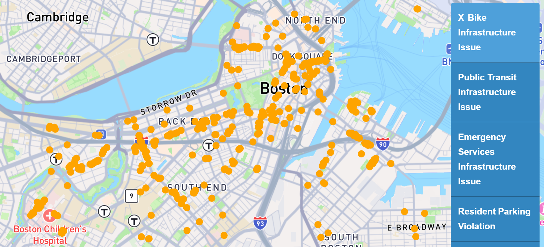
The goal of this project is to utilize the vast amount of publicly accessible data to create a geospatial visualization of where pedestrian, bike, and public transit infrastructure encounters the most issues. This is accomplished by classifying Illegal Parking reports made to Boston 311. The main issue with these Illegal Parking reports is that this category encompasses everything from resident-only parking to blocked bus stops and bike lanes. This lack of categorization prevents this data from being properly utilized to diagnose the issues with Boston's transportation network.
These Illegal Parking reports contain a free-form text description of the issue, from which classifications can be determined. Because of this, the project became a matter of Text Classification, a common task in Natural Language Processing. The first iterations of this project aimed to leverage word embeddings for text classification using the Lbl2Vec model. The report of this strategy can be read here. To summarize, despite promising metrics evaluating the word embeddings and clustering of documents, the actual utility of this iteration of the project was very low.
Following a review of this strategy with Professor Amir Tahmasebi, I devised more effective strategies, beginning with classical Machine Learning Text Classification strategies. Utilizing TF-IDF vectorization for word and document representation, I tested various classification and clustering algorithms such as K-means, HDBSCAN, AgglomerativeClustering, and FeatureAgglomeration. These strategies yielded less than useful results, with many algorithms making classifications along the lines of street names; and makes, models, or types of vehicles. To combat this, I explored Feature Engineering on the data in order to yield classifications along infrastructure types through masking and keyword amplification. Despite these efforts, classical Machine Learning strategies were not viable for this project.
Finally, I implemented a keyword-based classification system with fuzzy matching for this project. The benefits of this strategy were that it mimics how a human would make these classifications, it is agnostic to classification structures, and its simplicity means the time to classify large datasets (>25k documents) is low. Without fuzzy matching, this keyword-based classification was able to categorize ~65% of documents with extremely high accuracy (low false-positive rate is another benefit to this strategy).
The project repository contains JuPyter notebook files which collect the raw data from the Boston 311 API, classify the data, then process it for visualization; the rest of the repository is dedicated to the visualization of the data.
Interactive Map GitHub Repository Read about the Lbl2Vec StrategyBICRE: Boston Integrated Cycle Route Engine
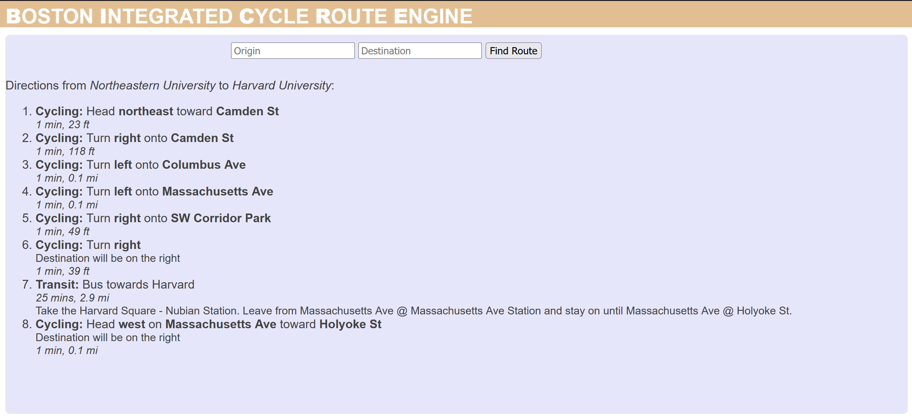
The Boston Integrated Cycling Route Engine was created to address a problem I have encountered when using Google Maps for navigation. It lacks the ability to create a route that utilizes both cycling and transit. A key part of the Dutch transit system that I experienced was its intermodality.
Many people in the Netherlands used a combination of biking and transit to get them to and from their destinations. This is a great way to improve the utility of existing transit service, as it solves the issue of first and last mile legs of public transit trips. Due to the nature of public transit, it cannot take every user directly to their destination, so it is usually combined with walking to achieve this. If all users walk to a transit station, the catchment area is considerably smaller than if users have the ability to utilize cycling.
Already, much of the MBTA system is bike-friendly. Bikes are allowed on subways and commuter rail at most times except direct rush hours, and the vast majority of the MBTA’s fleet of buses have bike racks on the front available for use. The largest hurdles of combining cycling and transit is planning the route. Services like Google Maps lack the ability to create combined routes utilizing the two modes of transport. BICRE aims to solve this issue by enhancing the Google Maps service to create integrated cycling and transit routes between two places. More information about this project can be seen on the README of the GitHub repository.
GitHub RepositoryMBTA Slow-zones Data Analysis

I co-created a data analysis and visualization project to communicate and illustrate the MBTA’s issues with speed restrictions and to investigate the impact of slow-zones on system ridership.
Analysis GitHub RepoROVE: Ridership Operations Visualization Engine
ROVE is a tool developed by the MIT Transit Lab for performance analysis of bus transit systems. It uses General Transit Feed Specification (GTFS) data to create interactive visualizations to support the analysis of the effectiveness of bus transit services. The original paper was sent to me by Jeff Rosenblum while I was abroad in the Netherlands studying Sustainable Urban Development and Transportation. Because of my recent experiences both studying and using Dutch bus systems in The Hague, Amsterdam, and Rotterdam, I wanted to compare the data provided by OV (Openbaar Vervoer, Dutch transit authority) to the example systems provided by ROVE (MTA, MBTA, etc.). However, the OV GTFS data was not compatible with the ROVE system.
I endeavored to make slight modifications to the ROVE system to assuage the issues between it and the OV GTFS data. This was my first project in Python, and it was a great introduction to Pythonic development and debugging.
GitHub RepositoryChord Recognition and Progression Predictor
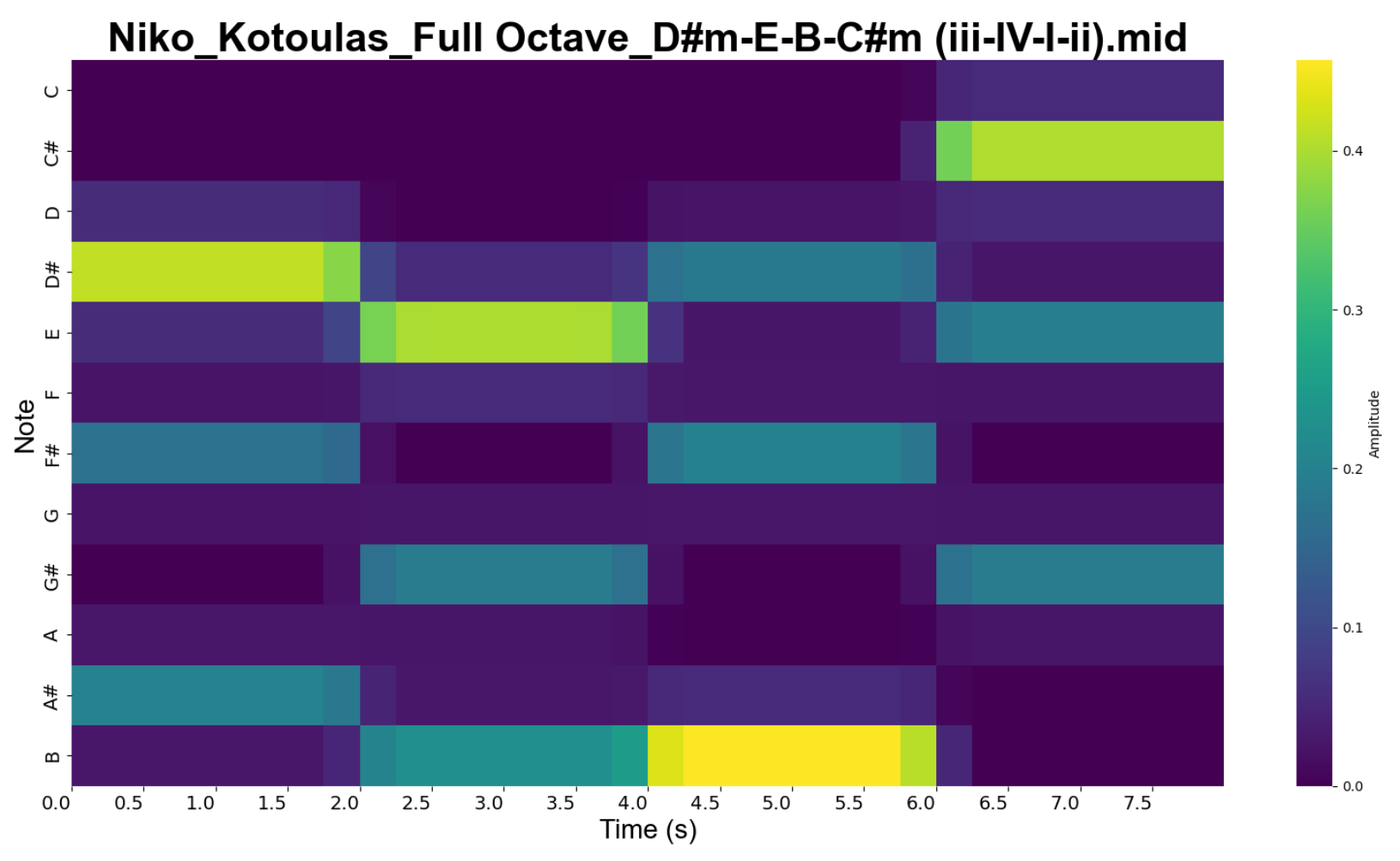
Using an ensemble approach for chord recognition followed by a Hidden Markov Model for chord prediction, this project applies key AI concepts to music and sound data to create an entertaining model to interpret and predict chord progressions.
Report GitHub Repository